A USB stick that costs about as much as a decent dinner, listening to marine VHF, weather radio, aircraft, AIS, the 433 MHz sensors in your lockers, and — in theory — weather satellites overhead.
And why it changes what a radio costs
An ordinary radio is built to receive one kind of thing. The circuits inside are physically shaped around marine VHF, or FM broadcast, or AIS, and that is all they will ever do.
A software defined radio does almost none of that in hardware. It grabs a slice of raw radio spectrum, converts it straight to numbers, and hands the numbers to a computer. Everything else — tuning, filtering, demodulating, decoding — is software.
Which means the same piece of hardware is a different radio depending on what program you run. Change the software, change the radio. That is the whole idea, and it is why one cheap dongle replaces a shelf of single-purpose receivers.
| Spec | What's aboard |
|---|---|
| Dongle | RTL-SDR Blog V4 |
| Tuner chip | Rafael Micro R828D |
| Frequency range | 500 kHz – 1.766 GHz |
| HF | Yes — the V4 reaches down into the shortwave bands |
| Connection | USB, on a powered hub |
| Transmit | No. Never. |
That range covers essentially everything a boat cares about, from shortwave weather fax at the bottom to ADS-B aircraft transponders at the top.
Because the command line is no good at anchor
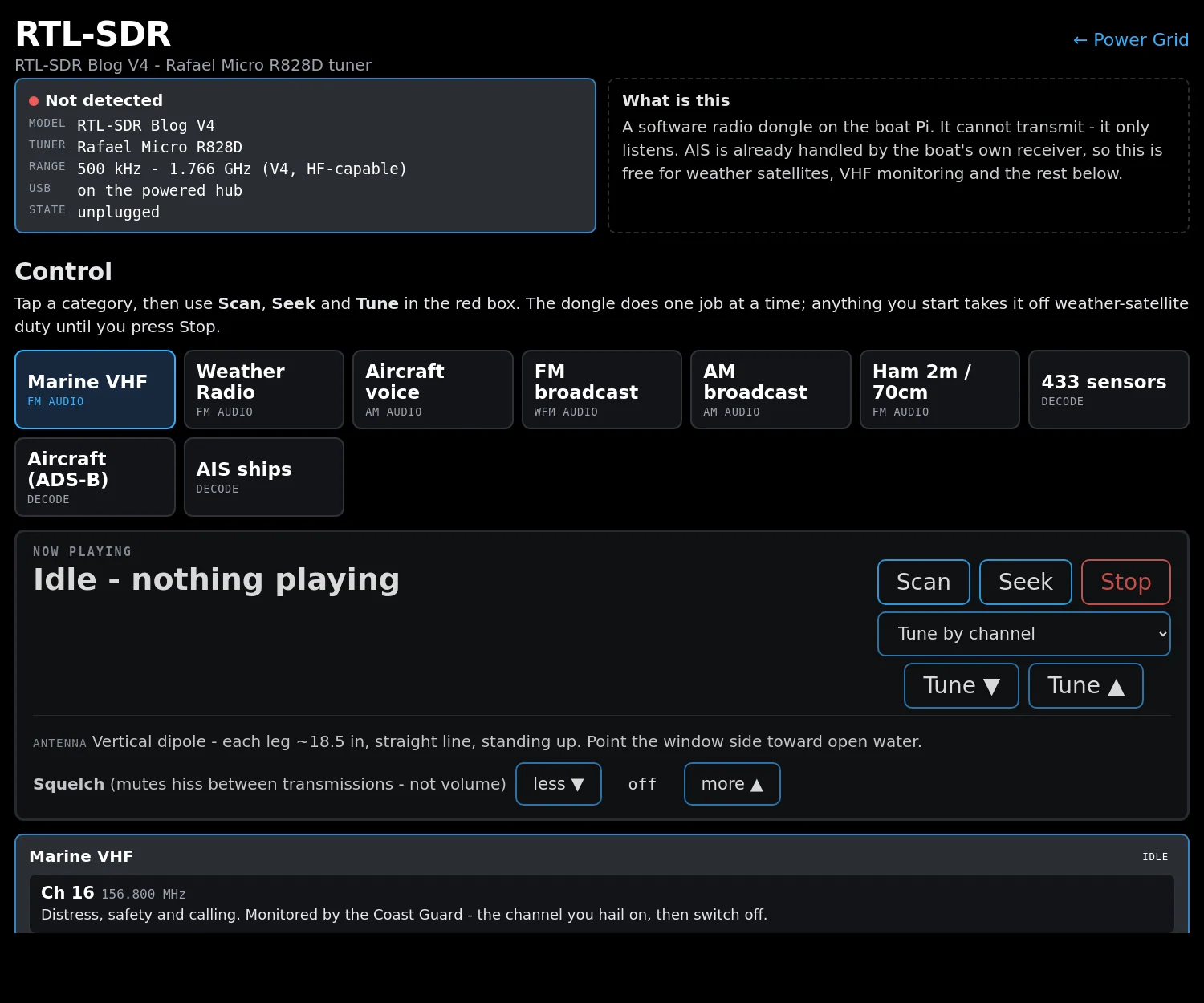
The SDR page on the boat's own screens. One tap per job.
All the software that drives an SDR is command-line, and all of it wants different arguments. That is fine at a desk and useless on a boat at two in the morning, so it got a page.
The parts that work
A second pair of ears on 16 and the working channels, logged and available on any screen aboard — without tying up the real VHF.
The continuous US weather broadcast, on tap, without finding the handheld.
The boat has a proper AIS transceiver, so this is redundancy rather than necessity — but a second independent receiver for the price of nothing is not a bad thing.
The band cheap wireless sensors use. Temperature tags, tyre sensors, doorbells, weather stations — a surprising amount of a boat is shouting on 433 and this hears all of it.
Aircraft position transponders, decoded. Not navigationally useful, genuinely interesting, and an excellent way to prove the receive chain works.
Ham bands, AM and FM broadcast, shortwave. For a boat heading somewhere with no internet, a wide-band receiver is not a toy.
This is the bit that has not worked
The whole automated capture chain is built and running — tracking the passes, starting the receiver at the right moment, recording the pass, decoding it to an image, and filing it. It fires on schedule and it produces files.
The images are rubbish. Noise, partial lines, no usable picture.
The software is not the problem. The problem is the antenna, and we have not yet found one that works on a boat.
The polar-orbiting weather satellites transmit around 137 MHz, and they pass overhead for roughly ten to fifteen minutes at a time, moving horizon to horizon. To receive them properly you need an antenna with a clear view of most of the sky, with the right polarisation, in roughly the right orientation.
A sailboat is close to the worst possible site for that:
So: the project is unfinished and we're saying so. It would be easy to leave this page describing the software and let you assume it works. It doesn't, yet.
Because a weather satellite image is a picture of the sky above you, right now, received directly, with no internet involved at all. Offshore that is a genuinely different thing from a forecast:
 Exodus